The Great Divide – remnants of the Great Flood of 2011
PHOTOS AND VIDEO
FROM DRIFTWOOD JOHNNIE (aka John Ruskey of Quapaw Canoe Company)
“Last week the river dropped below flood stage (44 in Helena) and the big sandbar islands started demonstrating their resilience in the face of the highest water on the biggest river in North America.
The wind shifted to a Northly breeze, perfect for a long run downstream. I made a thirty mile canoe run and saw an amazing variety of creation — and destruction.
The bad news: a lot of man-made property is gone or severely compromised.
The good news: the trees and re-leafing and re-flowering and the animals are continuing their life cycles. Even at this somewhat lower level the river is still exploding with all of its famous fury…“
–Driftwood Johnnie
FROM THE DELTA BOHEMIAN
Poor William has done the unexpected again….
When Magical Madge and Poor William first witnessed a particular wheat field near Friars Point in Coahoma County several weeks after the floodwaters had receded from the Mississippi River Flood of 2011, they were astounded. The wheat field they had seen not more than 6 weeks prior had been under 15-20 feet of flood water and was now drained and abandoned by the river. She left in her vanished wake a field laid down, stripped and leached of it’s once fertile crop of wheat.
But the river didn’t stop there. It found a weak spot within the land and worked it’s way into it….digging and gouging out a crevasse which gave an illusion of a Mississippi Delta Grand Canyon of sorts.
The gouge was wide and it was deep and Poor William and Magical Madge wondered for a moment if they were somehow somewhere else because it felt like they were on the moon or some such strange place they had never been before.
No. Never had they seen the remnants left by a flooding and raging Mississippi River as they saw that day standing in the huge wheat field, now barren and also robbed of it’s fertile soil.
This Mississippi Delta mini Grand Canyon – or Great Divide – surely 200 yards across – was too tempting for Poor William. He had to swim across it! It took him a good 20 minutes or more to walk from one side of the crevasse around to the other, all the while tromping across the dry, prickly and dead wheat field.
As he descended down to the water’s edge, the Mississippi River water’s edge, now projectiled into the field, he began to wonder about what might lie in wait under the water before him.
Were there beds of water moccasins underneath the surface? Were alligators floating nearby, still and undetectable?
Thoughts and many more filled Poor William’s mind as he approached the water and put his feet in, cloaked in rubber garden shoes.
What happened next? Watch the Video and you will see.
But….what you won’t see are the thoughts of Poor William once he set out on his mission to swim across The Great Divide.
Stay tuned next week when Poor William will take you on a minute by minute regurgitation of his thoughts as he made his way across The Great Divide created by the Mississippi River Flood of 2011.
You will be amazed and you will understand and you will question – Why?
–by Magical Madge
To be continued…..
SPECIAL NOTE–Driftwood Johnnie (aka John Ruskey) regarding the pond Poor William swam in: “Some people say they’re called blue holes, because the ol’ muddy mississippi clears out in these isolated pools. Other people say the term is “blew” holes, because they are formed by getting blown out during the high water.
Either way, a unique phenomena of our precious river!”
IT’S A BLUE BLEW HOLE!
WATCH THE VIDEO
– – – – – – – – – – – – – – – –

The Great Divide – remnants of the Great Flood of 2011

The Great Divide – remnants of the Great Flood of 2011

The Great Divide – remnants of the Great Flood of 2011

The Great Divide – remnants of the Great Flood of 2011

The Great Divide – remnants of the Great Flood of 2011

The Great Divide – remnants of the Great Flood of 2011
SO SORRY BUT SOMEHOW WE LOST MANY OF THE IMAGES BELOW.
- Not surprisingly, old man raccoon has been wandering the newly exposed landscape — he’s a tough survivor of almost any situation… Photo by Delta Bohemian John Ruskey
- Deer Tracks!! Amazing creatures — the deer survived the flood — either hanging onto driftwood or swimming back from shore — either way what an amazing creature! Photo by Delta Bohemian John Ruskey
- Is the water still moving strong? Hee-hee, we are talking about the Mighty Mississippi — and the “mighty” part isn’t any exaggeration — colossal convulsions of water exploding upwards & outwards from unseen depths the raucous spiraling and wave-making! Photo by Delta Bohemian John Ruskey
- What about the migrating Terns? (Who come in all the way from Patagonia) Will they find sandy places to make their nests? Yes! They are everywhere busy in their displays of courtship, which will soon lead to nest building… Photo by Delta Bohemian John Ruskey
- What about the migrating Terns? (Who come in all the way from Patagonia) Will they find sandy places to make their nests? Yes! They are everywhere busy in their displays of courtship, which will soon lead to nest building… Photo by Delta Bohemian John Ruskey
- Its still high water — this is all that remains of Is. 67. Photo by Delta Bohemian John Ruskey of Quapaw Canoe Company
- Bereaved Fishing Camp with highwater mark halfway up its walls. Photo by Delta Bohemian John Ruskey of Quapaw Canoe Company
- Round Bales Carried by the highwater behind Old Levee and deposited on road to Burke’s. Photo by Delta Bohemian John Ruskey of Quapaw Canoe Company
- Field still draining… Driftwood piled against pivot… Photo by Delta Bohemian John Ruskey of Quapaw Canoe Company
- The first thing that caught my eye coming out of Quapaw was that the old levee had been cut in half. My friends the Cliff Swallows were hanging on though — they like to burrow into steep muddy banks. Photo by Delta Bohemian John Ruskey of Quapaw Canoe Company
- Break in the old levee at Burke’s — water pouring into the fields even with the river below flood stage. Photo by Delta Bohemian John Ruskey of Quapaw Canoe Company
- You can feel the force of the water as it was pouring through the woods along Burke’s. Photo by Delta Bohemian John Ruskey of Quapaw Canoe Company
- The raging water scoured the landscape. Photo by Delta Bohemian John Ruskey of Quapaw Canoe Company
- Elm Tree with its roots & trunk scoured clean & exposed from the flood of 2011. Photo by Delta Bohemian John Ruskey of Quapaw Canoe Company
- Meanwhile across the river in Arkansas (near Elaine) once fertile fields adjacent the main channel have been grated down by the flooding river to gravel & hard muds below. Photo by Delta Bohemian John Ruskey of Quapaw Canoe Company
- These once productive fields near Elaine Arkansas have been trashed by the flooding river — all of the rich soil & fertilizers are now blown out over the Gulf of Mexico somewhere between Cuba and the Yucatan Peninsula! Photo by Delta Bohemian John Ruskey of Quapaw Canoe Company
- Utram Bibis? Aquam an Undum? (Which do you drink, the Water or the Wave?) Photo by Delta Bohemian John Ruskey of Quapaw Canoe Company
- Who else is enjoying the dry ground? A Rough Green Snake climbing a cottonwood. Photo by Delta Bohemian John Ruskey of Quapaw Canoe Company
- Wow, things don’t look so good with the things made by man along the side of the river, the old levee, the fields, the hunting camps, the access roads — what about in the forests and on the islands, how is the animal kingdom doing? The first tracks I found upon landing on the first bluff of sand I found — Island 64. Photo by Delta Bohemian John Ruskey of Quapaw Canoe Company
- I’m happy to report that the Sean Rowe Monument survived: Utram Bibis? Aquam an Undum? Photo by Delta Bohemian John Ruskey of Quapaw Canoe Company
- Oh, okay, it was this guy — a Mississippi Map Turtle — enjoying the first sand to be uncovered — the feeling of the full sun on his cold shell (cold water) — and life goes on… Photo by Delta Bohemian John Ruskey of Quapaw Canoe Company
- Oh, okay, it was this guy — a Mississippi Map Turtle — enjoying the first sand to be uncovered — the feeling of the full sun on his cold shell (cold water) — and life goes on… Photo by Delta Bohemian John Ruskey of Quapaw Canoe Company
- And these???? Photo by Delta Bohemian John Ruskey of Quapaw Canoe Company
- And yes, sadly enough man has already made his mark on the otherwise pristine island landscape — I would be more upset about this display if it hadn’t been so artfully created — was this some redneck’s spin on the bottle-tree? Photo by Delta Bohemian John Ruskey of Quapaw Canoe Company
- …life goes on… Why was the Mississippi Map Turtle digging this hole in the sand? And thewn covering it up? To bury her fresh laid eggs!! Photo by Delta Bohemian John Ruskey of Quapaw Canoe Company
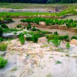
- The Great Divide – a wheat field gouged out by the Mississippi River. Photo by The Delta Bohemian
- A mini Grand Canyon in the Mississippi Delta after the Flood of 2011. Photo by The Delta Bohemian
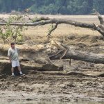
- An uprooted tree left in the middle of a wheat field in the Mississippi Delta near Friars Point after the Flood of 2011. Photo by The Delta Bohemian
- Joey holding Poor William’s personal articles prior to his swim through the great divide. Photo by The Delta Bohemian
- A single leaf left among the battered young wheat stalks in a field after the flood of the Mississippi River 2011. Photo by The Delta Bohemian
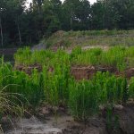
- Young wheat bent over and leached of it’s nutrients after being flooded by the Mississippi River 2011. Photo by The Delta Bohemian
- Up close and personal with a singular leaf amidst a dead wheat field after the Mississippi River Flood of 2011 near Clarksdale. Photo by The Delta Bohemian
- Poor William standing next to a favorite tree that is no longer standing proud next to the great divide near Friars Point. Photo by The Delta Bohemian
- Debris piled up and left abandoned after the flood waters receded following the Mississippi River Flood of 2011. Photo by The Delta Bohemian
- Tom “Bunny” McKee and Poor William near Friars Point. Photo by The Delta Bohemian
- Even in hard and bad times, good times abound among friends. Photo by The Delta Bohemian
- Tom “Bunny” McKee giving directions near Friars Point. Photo by The Delta Bohemian
- Joey and Poor William examining a large hole which once was not – thanks to the Mississippi River Flood of 2011. Photo by The Delta Bohemian
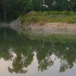
- Poor William wondering how the huge hole was created by the Mississippi River Flood of 2011 and wondering exactly what might be in the mysterious pool. Photo by The Delta Bohemian
- Sand is now littered on this wheat field along with a huge missing piece of land – now somewhere downstream or in the ocean – thanks to the Mississippi River Flood of 2011. Photo by The Delta Bohemian
- Surely there are no gators or snakes out there?!! Photo by The Delta Bohemian
- Young wheat beat down by the Mississippi River Flood of 2011. Photo by The Delta Bohemian
- A huge gouge in a wheat field – a result of the Mississippi River Flood of 2011. Photo by The Delta Bohemian
- Young wheat stalks stripped bare after being inundated by the Mississippi River Flood of 2011 near Friars Point and Clarksdale, MS. Photo by The Delta Bohemian
- A barren and now sandy wheat field showing signs of life – wildlife, that is, near Clarksdale, MS after the Mississippi River Flood of 2011. Photo by The Delta Bohemian
- Poor William talking about his swim across the great divide near Clarksdale. Photo by The Delta Bohemian
- Debris left by the Mississippi River Flood of 2011. Photo by The Delta Bohemian
- Tom “Bunny” McKee and Poor William. Photo by The Delta Bohemian
- The Great Divide near Friars Point and Clarksdale. Photo by The Delta Bohemian
- Poor William’s tired legs after his swim. Photo by The Delta Bohemian
- Having a cold one after his swim. Photo by The Delta Bohemian
- Heading back but had to pause and have a look at this site. Photo by The Delta Bohemian
- Poor William sharing his experience of crossing the great divide. Photo by The Delta Bohemian
- Feeling stronger. Photo by The Delta Bohemian
- The Great Divide – what once was a beautiful field ripe with young wheat is now stripped and bent and leached dry – AND – rich, fertile Mississippi Delta dirt is now gone forever with the Mississippi River Flood of 2011. Photo by The Delta Bohemian
- The Great Divide – remnants of the Great Flood of 2011
- The Great Divide – remnants of the Great Flood of 2011
- The Great Divide – remnants of the Great Flood of 2011
WE HIGHLY ENCOURAGE COMMENTS!!


Bravo Billy & Madge! What did y’all do, stay up all night long putting this together?
I’m sure y’all know, but Billy what you swam through is a newly formed “blue hole.” They are located all over the Mississippi Valley, some of them become spectacular swim places. Well, you demonstrated that, although it looks to me like you had too many clothes on!
Some people say they’re called “blue holes,” because the ol’ muddy mississippi clears out in these isolated pools. Other people say the term is “blew” holes, because they are formed by getting blown out during the high water.
Either way, a unique phenomena of our precious river!
Driftwood Johnnie, one of us stayed up all night and it was not Poor William–I am merely the big picture guy who spouts out ideas staccato and the Magical One makes it happen and sits at the computer for 24-hours straight. She is THE DELTA BOHEMIAN; I am merely a fat man with some kind of governor missing, and though I may swim a blue/blew hole, you my aquatic friend, are the one with the massive cajones who will swim in the river at crest! What a pleasure for Madge and I to be able to count you and Miss Sarah as our friends and our muses! Gracias mi amigos! Guillermo de Pobre
I swear fo God Boy, you ain’t got a lick of sense! That Blue/blew hole is full of bug killer, cotton defoliant and god knows what else! If you are going to continue to misbehave you just need to remember that Magical Madge is going to look really fetchin in black one of these days when you are frozen nekkid in the snow, divin into water jest cause it is there and bein stuck in a hole in the ground you can’t get out of and wearin a suit!
i was thinking the same thing. be careful reporting all this stuff to us.
have fun, hard to have fun and be careful. so be funful.
Jimbo, well stated! Funful is a great word! Thanks! Poor William
I love me some Jane Tucker Bond. Honey, sometimes a man gots ta do what a man’s gots ta do–do stuff just ’cause it’s there, but you get that. Now, I am waiting on the opportunity to send you a pepper; Madge says it’s okay! HA! 🙂 Come see us in the upper Delta sometime! Poor William
I love me some Jane Tucker Bond. Honey, sometimes a man gots ta do what a man’s gots ta do–do stuff just ’cause it’s there, but you get that. Now, I am waiting on the opportunity to send you a pepper; Madge says it’s okay! HA! Come see us in the upper Delta sometime! Poor William